Flypix - Revolutionizing Geospatial Solutions with AI Technology
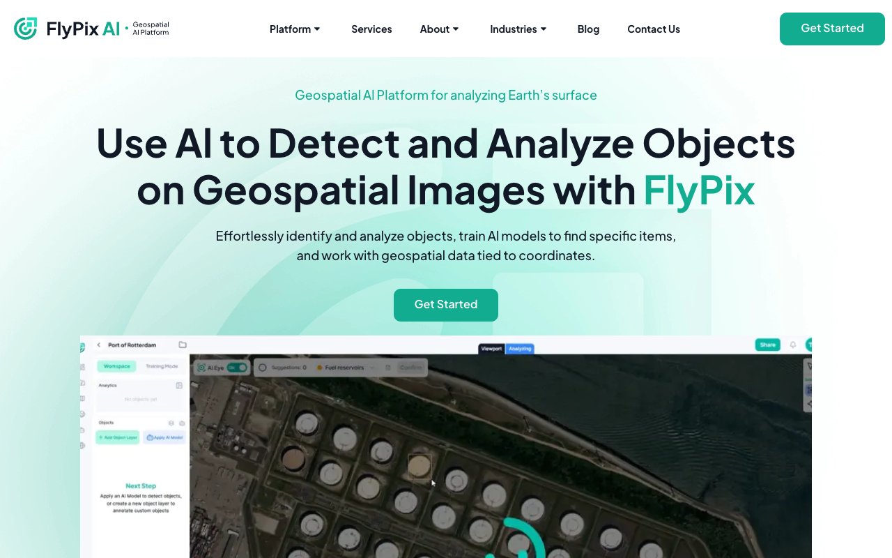
Flypix offers cutting-edge AI-enabled geospatial solutions that are transforming the way industries analyze and interpret geospatial data. With a focus on object detection, localization, tracking, and monitoring, Flypix’s advanced AI technology provides actionable insights for various sectors, from government agencies to construction companies.
By harnessing the power of Aerial and Satellite Imagery, Flypix empowers users to create customized AI use cases without the need for prior knowledge of AI or Machine Learning. From detecting objects to segmenting land in earth observation data, Flypix simplifies complex geospatial processes, making them accessible and efficient for all users.
Experience the future of geospatial technology with Flypix’s AI-driven approach, where precision, efficiency, and innovation converge to deliver unparalleled insights. Visit Flypix at flypix.ai to explore how their GEO AI platform can elevate your geospatial operations to new heights.